


Agricultural lending has always required a unique understanding of collateral that changes with the seasons, weather patterns, and market conditions. As portfolios grow and regulatory scrutiny increases, traditional methods of tracking farm operations and assessing risk are no longer sufficient. Today’s agricultural lenders need an enterprise mapping and portfolio risk management solution that delivers real-time visibility, automated monitoring, and comprehensive risk scoring across their entire loan portfolio.
The Challenge Facing Modern Agricultural Lenders
Farm Credit institutions, agricultural banks, and specialized ag lenders manage billions in agricultural loans secured by land, equipment, crops, and livestock. Unlike commercial real estate or business equipment, agricultural collateral is inherently dynamic. A 500-acre corn operation’s risk profile can shift dramatically based on planting decisions, weather events, commodity prices, and operational changes—often within a single growing season.
Traditional portfolio management approaches rely on annual reviews, manual field inspections, and static spreadsheets. This creates several critical challenges:
Limited visibility between review cycles: Most lenders conduct comprehensive portfolio reviews once or twice annually. In the intervening months, significant changes can occur without the lender’s knowledge—acreage shifts, crop rotations, new leases, or encroachments on collateral properties.
Inefficient risk assessment processes: Credit officers spend hours manually aggregating data from county assessors, FSA records, and borrower-provided information to understand their collateral position. This manual process is time-consuming, error-prone, and difficult to scale across portfolios of hundreds or thousands of loans.
Regulatory compliance pressure: The FFIEC and other regulatory bodies increasingly expect financial institutions to demonstrate sophisticated collateral monitoring and geographic risk management capabilities, particularly as climate-related risks become more prominent in agricultural lending.
Inability to identify geographic concentration risk: Many lenders unknowingly accumulate concentration risk in specific counties, watersheds, or soil types. Without mapping and geospatial analysis tools, these concentrations remain invisible until a drought, flood, or market event triggers multiple defaults simultaneously.
How Enterprise-Grade Mapping Transforms Agricultural Portfolio Management
A modern enterprise mapping and portfolio risk management solution addresses these challenges by integrating geospatial technology, real-time data feeds, and automated monitoring into a unified platform designed specifically for agricultural lenders.
Centralized Geospatial Intelligence
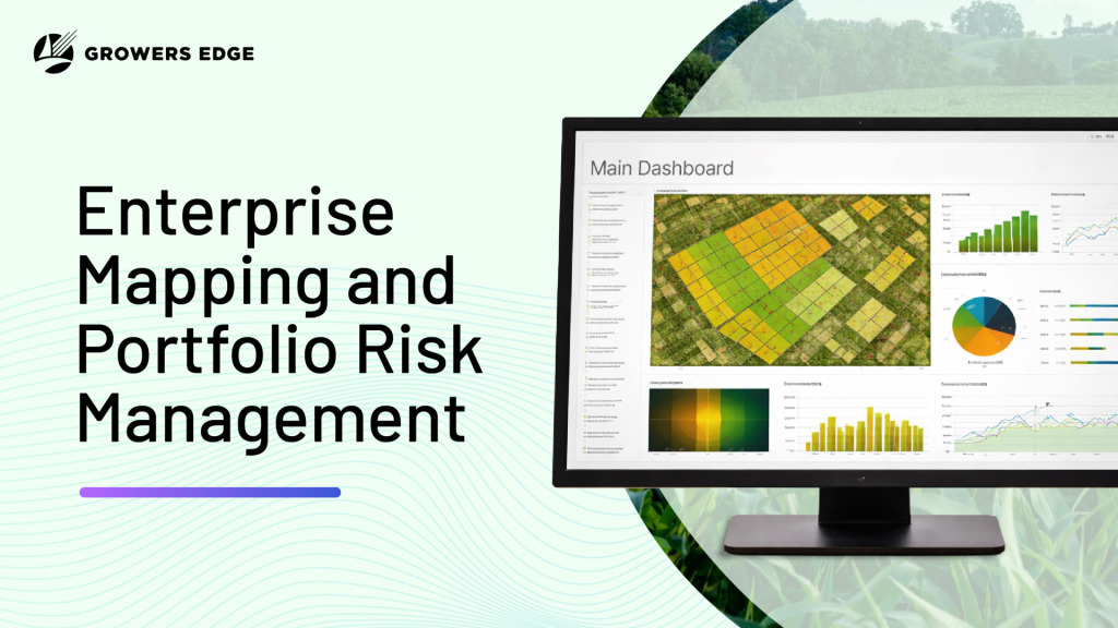
At the core of an effective agricultural portfolio risk management system is the ability to visualize every loan relationship on a map. This goes far beyond simple address plotting. Enterprise farm loan GIS software integrates:
- Parcel-level mapping of all collateral properties, including owned land, leased ground, and equipment locations
- Crop and land use data showing what’s planted where, field boundaries, and historical rotation patterns
- Overlay capabilities for soil types, flood zones, irrigation districts, and other geographic risk factors
- Multi-year historical views enabling trend analysis and change detection across the portfolio
When a credit officer opens a borrower’s file, they immediately see a comprehensive map of the operation—not just the primary collateral parcels, but the entire farming enterprise including rented ground that may impact repayment capacity. This geographic context transforms the credit review from a paper-based exercise into a data-driven analysis.
Real-Time Collateral Monitoring and Change Detection
Perhaps the most powerful feature of modern agricultural portfolio risk management platforms is continuous monitoring. Rather than waiting for the annual review, the system automatically tracks changes and alerts lenders to events that could impact collateral value or borrower capacity.
Automated acreage verification: By integrating satellite imagery and precision agriculture data, the platform verifies that borrowers are farming the acres they reported. If a 200-acre field shows up as fallow when the borrower reported planting corn, the system flags this discrepancy for investigation.
Ownership and lien changes: Real-time feeds from county recorders detect when properties change hands, new liens are filed, or ownership structures are modified. These changes automatically generate alerts, enabling the lender to take proactive action before their collateral position is compromised.
Environmental risk monitoring: The system tracks weather events, flood patterns, and drought conditions in real-time. When a severe storm impacts a region where the lender has significant exposure, credit officers receive immediate notification with a list of affected borrowers and estimated exposure.
Lease tracking and notification: Agricultural operations frequently add or drop leased ground. The platform monitors these changes and updates the borrower’s profile automatically, ensuring the lender maintains an accurate view of the farming operation’s scale and capacity.
One farm credit institution reported saving an average of 4.5 hours per annual review after implementing automated collateral monitoring. Across a portfolio of 800 agricultural loans, this translated to 3,600 hours annually—allowing credit officers to focus on relationship management and new business development rather than data gathering.
Agricultural Lender Collateral Monitoring: A Risk-Based Approach
Effective portfolio risk management requires more than just data collection—it demands intelligent analysis and risk scoring that helps lenders prioritize their attention on the highest-risk relationships.
Multi-Dimensional Risk Scoring
Enterprise agricultural portfolio risk management solutions calculate comprehensive risk scores by analyzing multiple factors simultaneously:
Geographic risk factors: Concentration in drought-prone areas, flood zones, or regions with declining land values. The system can identify when 30% of a portfolio is concentrated in three counties, creating unacceptable geographic risk.
Operational risk indicators: Changes in farming practices, reductions in planted acres, delayed planting windows, or shifts to lower-value crops all indicate potential stress in the operation.
Collateral coverage metrics: Real-time loan-to-value calculations based on current land valuations, commodity prices, and equipment depreciation. As market conditions change, the platform automatically recalculates coverage ratios across the portfolio.
Financial stress signals: Integration with core banking systems allows the system to incorporate payment history, covenant compliance, and financial statement trends into the overall risk assessment.
The platform aggregates these factors into a unified risk score for each borrower and loan, with color-coded dashboards that help portfolio managers quickly identify accounts requiring attention.
Portfolio-Level Risk Analytics
Beyond individual loan monitoring, enterprise mapping solutions provide portfolio-wide analytics that inform strategic decision-making:
Heat maps showing geographic concentration: Visual representations of loan density, total exposure by county or watershed, and concentration by crop type or operation size.
Scenario analysis capabilities: “What if” modeling that shows how portfolio risk would change under different stress scenarios—a 20% decline in corn prices, a severe drought in the western region, or a spike in interest rates.
Peer benchmarking: Comparison of the institution’s portfolio composition, risk metrics, and geographic distribution against regional and national benchmarks.
Regulatory reporting tools: Automated generation of reports required by examiners, including geographic risk concentrations, collateral monitoring procedures, and exception tracking.
Real-World Applications: Use Cases from Leading Agricultural Lenders
Case Study 1: Regional Farm Credit Association
| Organization Type | Regional Farm Credit Association |
| Portfolio Size | $2.4 billion in loans |
| Geographic Scope | 5 states |
| Primary Objective | Address regulatory concerns related to geographic concentration and collateral monitoring |
| Key Challenges | 1) Lack of systematic collateral monitoring between annual reviews
2) Excessive loan concentration in certain counties |
| Solution Implemented | Enterprise mapping and portfolio risk management platform |
| Scope of Implementation | • 1,200 borrower relationships • 4,500 individual parcels • 850,000 total acres mapped |
| Monitoring Capabilities | Real-time alerts for: • Ownership changes • Lien filings • Significant acreage changes |
| Key Findings | • 23 unreported collateral property sales identified • 38% of portfolio exposure concentrated in 12 counties |
| Operational Impact | Reduced annual review preparation time by 40% (from 8 hours to 4.8 hours per relationship) |
| Strategic Outcomes | Informed decisions to limit new originations in high-concentration counties |
| Regulatory Outcome | Regulatory concerns satisfied through documented, automated monitoring procedures |
Case Study 2: Community Agricultural Bank
| Organization Type | Community bank specializing in agricultural lending |
| Portfolio Size | $450 million |
| Growth Objective | Scale portfolio management to support growth from 300 to 500 agricultural relationships |
| Primary Challenge | Manual collateral and GIS processes limited the credit team’s ability to handle increased loan volume |
| Specific Pain Points | • Each new loan required 6 – 8 hours of manual GIS parcel mapping • Time-intensive collateral assessment and data entry |
| Solution Implemented | Automated parcel mapping and geographic risk scoring platform |
| Data Integrations | • USDA data sources • County-level property and parcel data |
| Process Improvements | Automation eliminated manual data entry and streamlined collateral analysis |
| Efficiency Gains | Reduced collateral analysis time from ~6 hours to 45 minutes per new loan |
| Staffing Impact | Enabled a 4-person credit team to handle 40% more volume with no additional hires |
| Risk and Pricing Impact | Improved loan pricing accuracy by incorporating geographic risk factors into rate decisions |
| Customer-Facing Benefits | Enhanced borrower presentations with professional mapping exhibits, differentiating the bank from competitors |
Case Study 3: Agricultural Equipment Lender
| Organization Type | Specialized equipment lender |
| Portfolio Size | 2,000 loans |
| Geographic Scope | 15 states |
| Primary Objective | Improve visibility into equipment location and usage to better manage collateral risk |
| Key Challenge | Reliance on borrower-reported equipment locations that were frequently outdated or incomplete |
| Operational Complexity | Equipment routinely moved between fields, leased properties, and custom work locations |
| Solution Implemented | GPS-based equipment tracking integrated with the portfolio management platform |
| Monitoring Capabilities | Real-time visibility into: • Equipment location • Usage patterns |
| Risk Findings | Identified 47 instances of equipment operating outside approved areas |
| Operational Impact | Reduced equipment repossession time from 14 days to 3 days using accurate location data |
| Pricing & Revenue Impact | Enabled usage-based pricing models that offered better rates to high-utilization borrowers |
| Recovery Outcomes | Improved recovery rates on defaulted loans by 18% through faster location and retrieval |
Integration with Existing Lending Infrastructure
A critical consideration for any enterprise agricultural portfolio risk management solution is seamless integration with existing systems and workflows.
Core Banking System Connectivity
The platform should connect directly to your core banking system, automatically syncing loan balances, payment history, covenant status, and borrower information. This eliminates manual data entry and ensures risk scores are always calculated with the most current financial data.
Data Feeds and Third-Party Sources
Effective agricultural lender collateral monitoring requires integration with multiple external data sources:
- County assessor and recorder offices for ownership, valuation, and lien information
- USDA Farm Service Agency (FSA) for crop reporting, acreage certifications, and program participation
- Weather and climate data providers for precipitation, drought indices, and growing degree day calculations
- Commodity pricing services for real-time market values that impact collateral and repayment capacity
- Satellite imagery and precision agriculture platforms for field-level monitoring and verification
Leading enterprise solutions maintain these integrations and provide standardized APIs that allow lenders to incorporate additional data sources as needed.
Workflow Automation and Alerts
Rather than requiring credit officers to log into a separate system, the platform should push relevant information into existing workflows:
- Email or text alerts when critical changes occur in monitored portfolios
- Automated generation of review materials with current maps, risk scores, and key metrics
- Integration with loan origination systems to pull collateral analysis into the approval process
- Dashboard widgets that provide at-a-glance portfolio health metrics without leaving the core banking system
FFIEC Guidelines and Compliance Considerations
The Federal Financial Institutions Examination Council (FFIEC) has established expectations for agricultural lenders regarding collateral monitoring and risk management. While specific requirements vary by institution size and risk profile, examiners consistently look for:
Documented collateral monitoring procedures: Written policies that describe how the institution tracks collateral value, verifies borrower-reported information, and responds to identified discrepancies.
Risk-based review frequency: More frequent monitoring of higher-risk relationships, with clear criteria for risk classification and escalation procedures.
Geographic concentration analysis: Regular assessment of portfolio concentration by county, watershed, or other relevant geographic boundaries, with established limits and management action triggers.
Environmental risk consideration: Incorporation of climate-related risks, including flood zone exposure, drought vulnerability, and long-term environmental trends into credit decisions and ongoing monitoring.
Modern enterprise mapping and portfolio risk management solutions help institutions meet these expectations by:
- Providing audit trails that document when collateral was reviewed, what changes were detected, and how the institution responded
- Automating risk-based monitoring so high-risk accounts receive more frequent attention without manual intervention
- Generating standardized reports that demonstrate compliance with established policies
- Creating geographic heat maps and concentration reports that can be presented to examiners and board members
Agricultural lenders should also reference USDA Natural Resources Conservation Service (NRCS) guidelines for soil quality, conservation practices, and sustainable land management. These factors increasingly influence collateral value and long-term operation viability, particularly as environmental risks become more prominent in agricultural lending.
Implementing an Enterprise Agricultural Portfolio Management Solution
Successful implementation requires careful planning and phased deployment:
Phase 1: Data Migration and System Setup (Weeks 1 – 4)
- Export loan data from core banking system
- Map borrower relationships and collateral parcels
- Configure risk scoring algorithms based on institution-specific policies
- Establish user accounts and permission structures
Phase 2: Team Training and Pilot Program (Weeks 5 – 8)
- Train credit officers on platform features and workflows
- Select 50-100 loans for pilot program
- Validate risk scores and mapping accuracy
- Refine configuration based on user feedback
Phase 3: Portfolio-Wide Rollout (Weeks 9 – 12)
- Complete mapping for all agricultural loans
- Activate automated monitoring and alert systems
- Integrate with core banking system
- Establish standard reporting and review procedures
Phase 4: Optimization and Advanced Features (Months 4 – 6)
- Implement scenario analysis tools
- Add additional data feeds
- Customize dashboards for different user roles
- Expand to include indirect agricultural exposure
Measuring ROI and Success Metrics
Financial institutions implementing enterprise mapping and portfolio risk management solutions typically measure success through several key metrics:
Efficiency gains: Reduction in time spent on annual reviews, collateral analysis for new loans, and portfolio reporting. Most institutions see 30-50% time savings within the first year.
Risk mitigation: Fewer collateral surprises, earlier identification of problem loans, and reduced charge-offs attributed to better monitoring. Leading lenders report 15-20% improvement in early problem loan identification.
Portfolio growth capacity: Ability to manage larger portfolios with existing staff, or reallocate staff time to revenue-generating activities like business development and relationship management.
Regulatory confidence: Fewer examination findings related to collateral monitoring, positive feedback on risk management procedures, and smoother examination processes.
Competitive differentiation: Ability to offer borrowers sophisticated portfolio management, faster credit decisions, and professional mapping exhibits that demonstrate the lender’s technology capabilities.
The Future of Agricultural Portfolio Risk Management
The agricultural lending industry is entering a period of rapid technological advancement. Tomorrow’s enterprise mapping and portfolio risk management solutions will incorporate:
Artificial intelligence and machine learning: Predictive models that identify early warning signs of financial stress, estimate probability of default based on operational and environmental factors, and recommend optimal loan structures.
Enhanced integration with precision agriculture: Direct connectivity to farm management systems, equipment telematics, and yield monitoring platforms, providing lenders with unprecedented visibility into operation performance.
Climate risk modeling: Sophisticated analysis of long-term climate trends and their impact on collateral values, crop suitability, and regional agricultural viability.
Blockchain-based property records: Real-time, cryptographically secured ownership and lien information that eliminates lag in collateral monitoring and reduces the risk of fraud.
Agricultural lenders who invest now in enterprise mapping and portfolio risk management solutions position themselves not just to meet current regulatory expectations, but to lead their markets as these technologies mature.
Conclusion
The transformation from manual, annual-review-based agricultural portfolio management to enterprise mapping and real-time risk monitoring represents one of the most significant advances in agricultural lending technology. For Farm Credit institutions, agricultural banks, and specialized lenders managing hundreds or thousands of agricultural relationships, these platforms deliver measurable improvements in efficiency, risk management, and regulatory compliance.
As portfolios grow, regulatory scrutiny intensifies, and environmental risks become more prominent, the agricultural lenders who thrive will be those who embrace comprehensive, data-driven portfolio management. Enterprise mapping and portfolio risk management solutions provide the technology foundation for this transformation—combining geospatial intelligence, automated monitoring, and sophisticated risk analytics into a unified platform designed specifically for the unique challenges of agricultural lending.
The question is no longer whether agricultural lenders should implement these solutions, but how quickly they can deploy them to maintain competitiveness and manage risk in an increasingly complex operating environment.
To learn more about how modern portfolio management platforms can transform your agricultural lending operations, explore Agcor’s enterprise mapping and risk management capabilities designed specifically for farm credit institutions and agricultural lenders. Our platform integrates seamlessly with your existing systems while delivering the real-time visibility and automated monitoring you need to manage portfolio risk effectively. Ready to see what enterprise mapping can do for your portfolio? Talk to an Agcor expert and get a personalized look at how our platform fits your lending operation. Book a meeting here.